

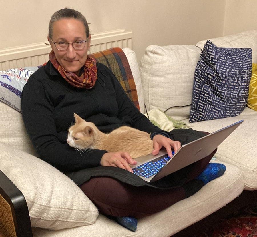
Cat-sitting gives you plenty of time to write, we’re finding, despite a few utterly foreseeable complications…
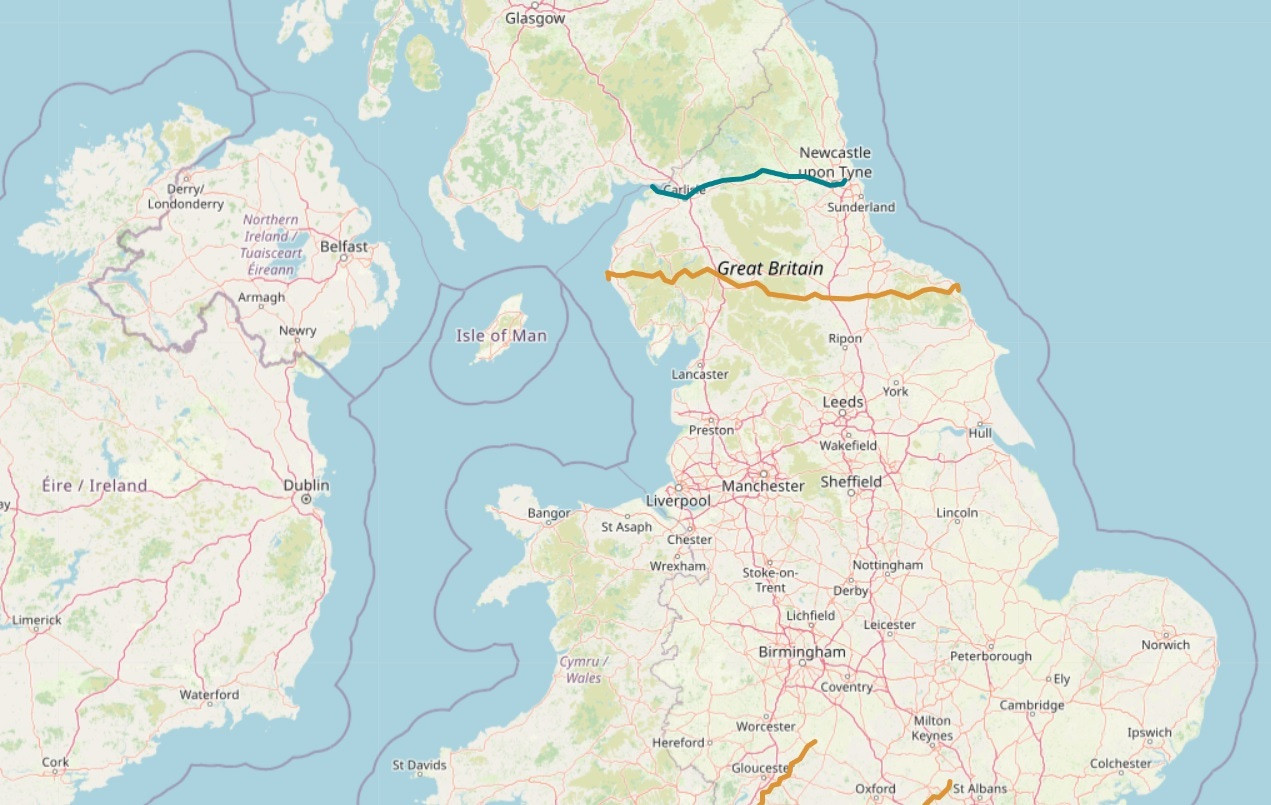
Even with a cat on your lap, there’s ample time to share a bit about our experiences this past summer on the Wainright Coast to Coast Path that I mentioned in our last update. This is a (theoretically) 192-mile route (not an official national trail quite yet) that runs through the north of England, from the Irish Sea on the west coast to the North Sea on the east. On the map below, it’s pretty much the orange line:
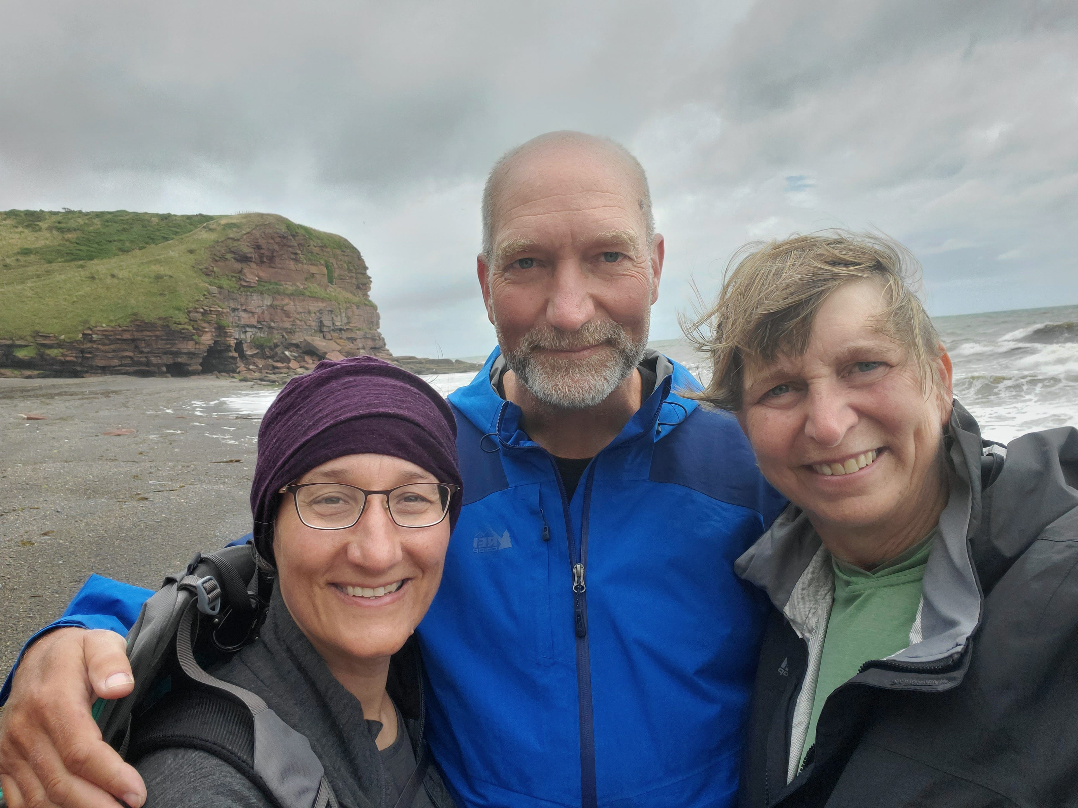
It’s not often you get the chance to walk all the way across a country, so my sister Mary joined us for the trip. It was great to have her, and not only for her beautiful photos (almost all of the photos on this post are hers). Going way back to her high school days, Mary was forced to drag her annoying little brother (that’s me) on lots of outings—she and her friends were always nice about it, but still…—so it was great to repay her many kindnesses by having her join us for this one. Let’s start with a quick look at the team (l-r: Cathy, Tom, Mary):
The normal route for the Coast to Coast Path begins in the seaside village of St. Bees (most people walk west-to-east so the prevailing winds—and the rain—are behind you). Imagine, if you will, the delights of a national rail system with service to small towns (about 1,8oo people in the 2021 census)—very handy indeed for those of us without cars.
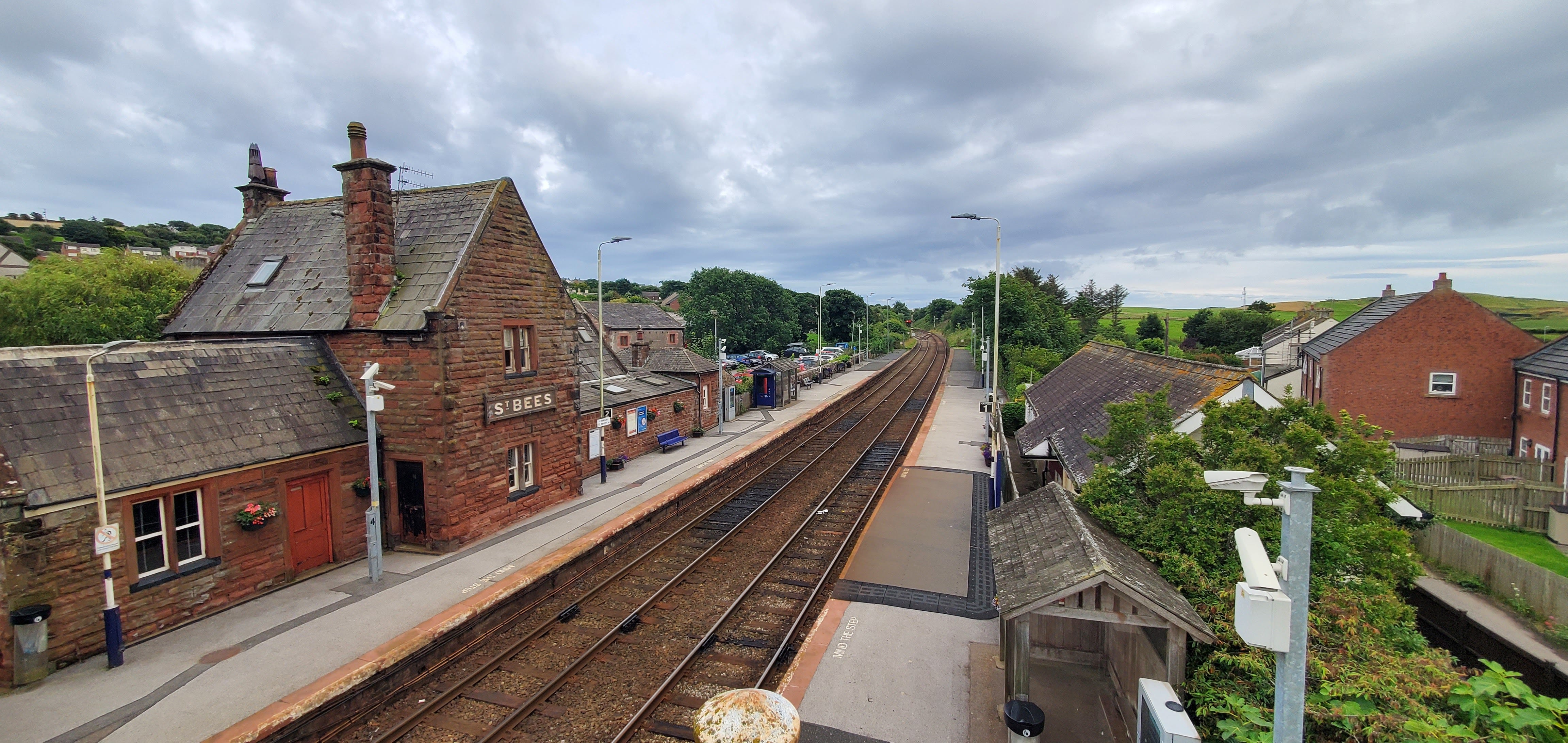
Day 1 of the Wainwright route traditionally follows a coastal path north from St. Bees, up to the lighthouse at St. Bees head, then cuts inland toward the Lake District, usually ending up somewhere around Ennerdale Water for the first night, covering far more distance than needed if you were to walk directly from St. Bees to Ennerdale Water.
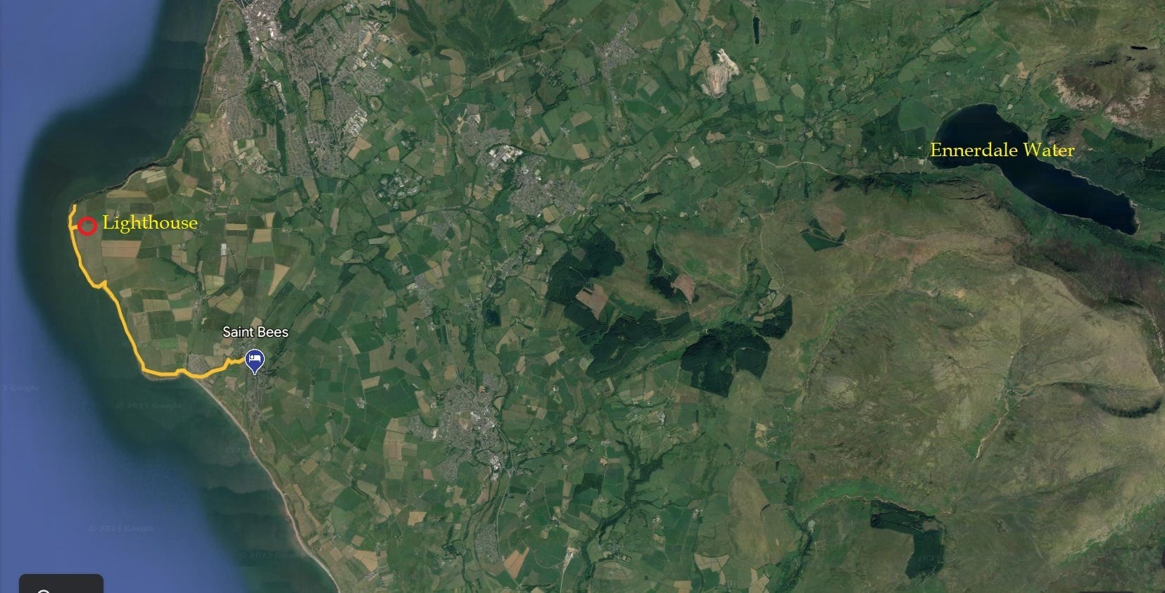
Being lazier than that, we hiked out to the lighthouse at St. Bees Head and back to our B&B (about 9-10 miles round trip) as a prelude to the big walk—a sort of “Day 0,” which would allow for a shortcut directly toward the Lake District the next day. An unorthodox approach, but as it turns out, we're not overly doctrinaire about these things. And besides, Wainright himself was very much in favor of people finding their own variants rather than slavishly following an "official" route.
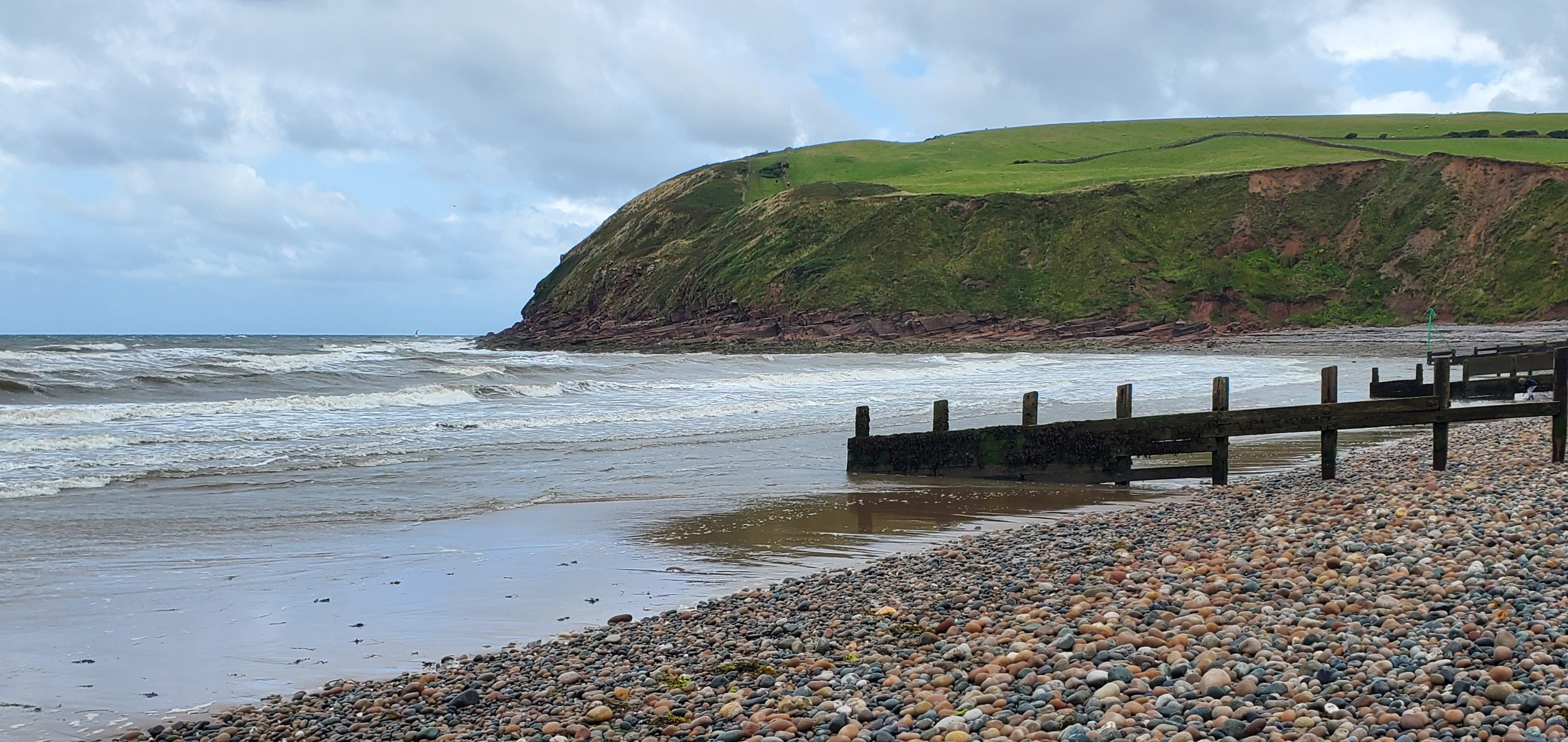
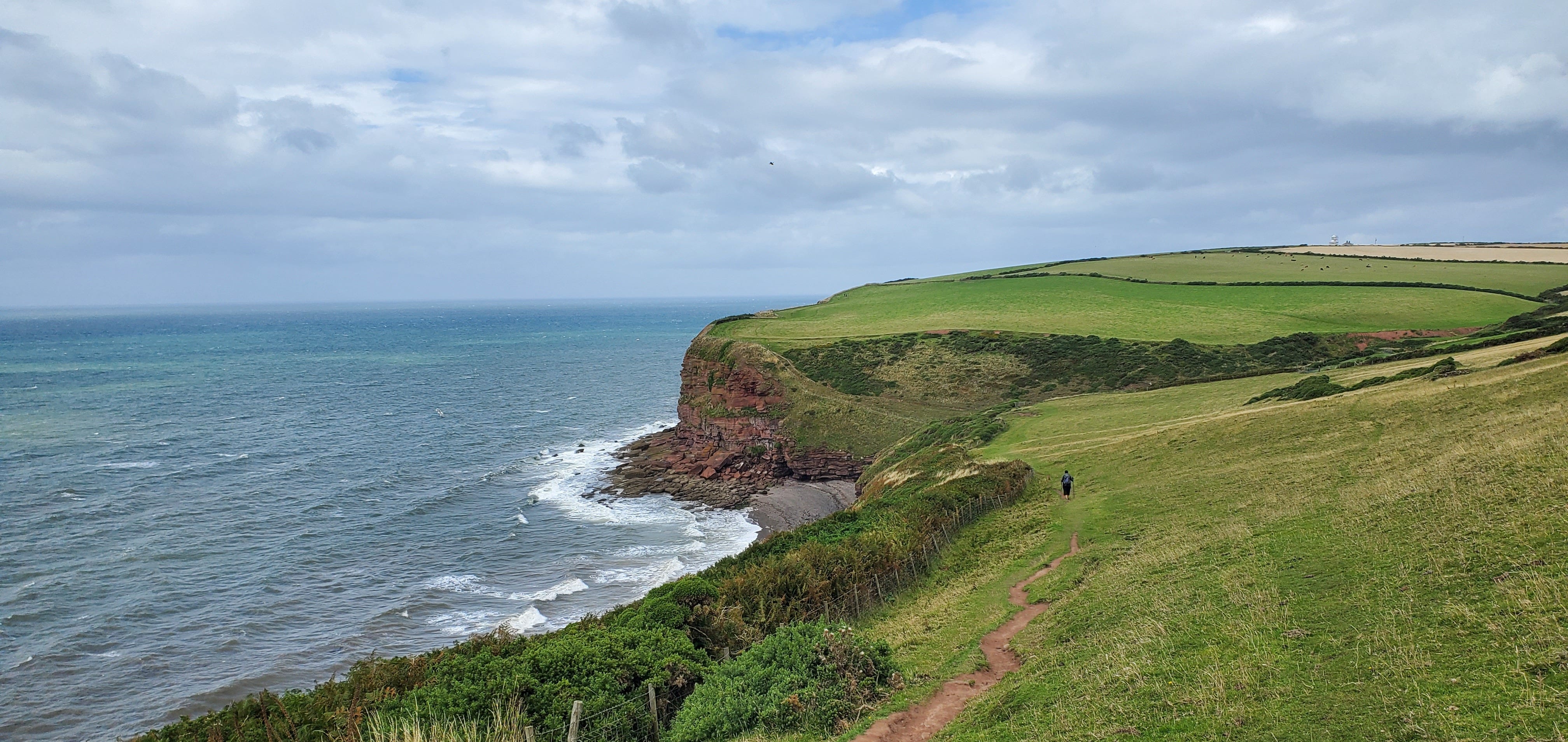
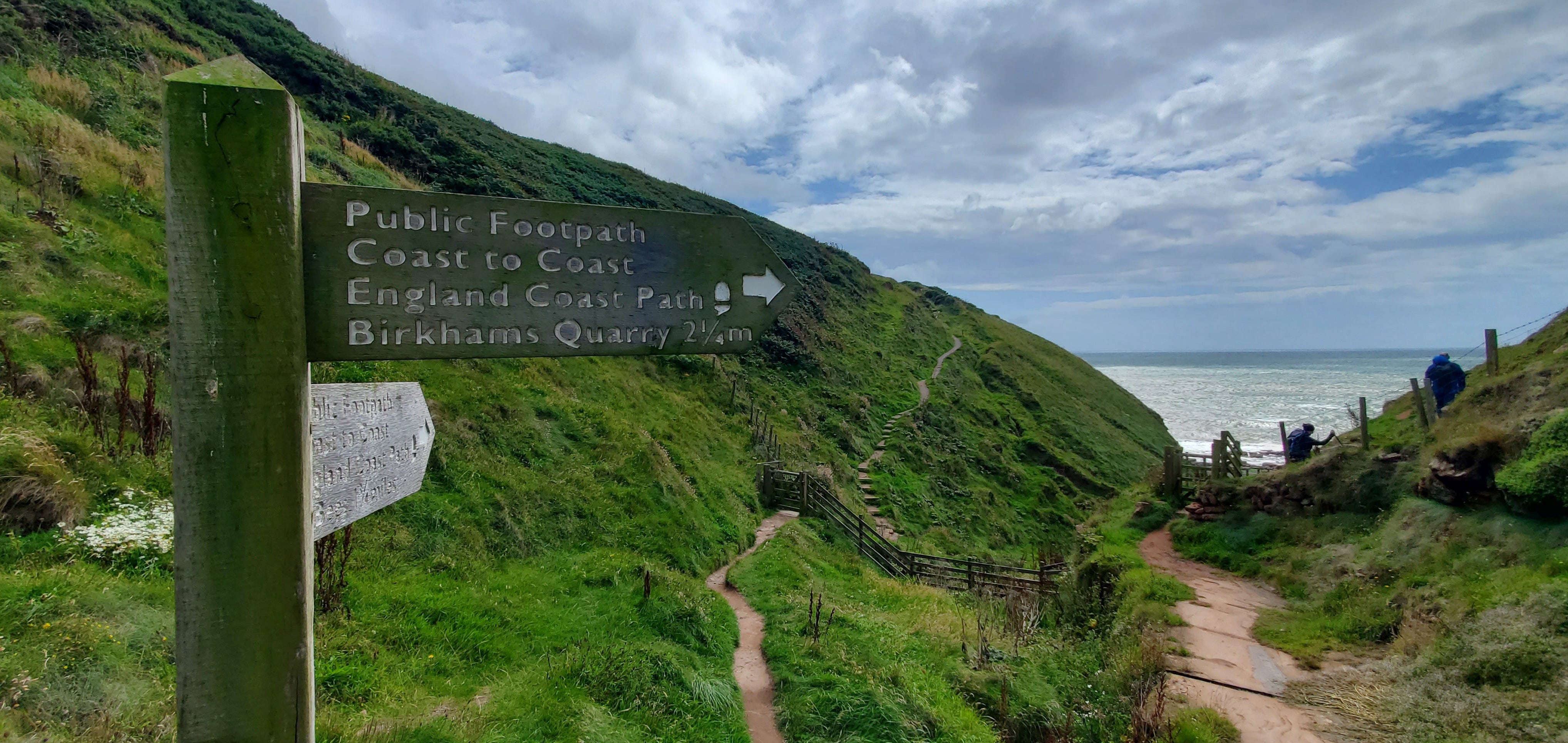
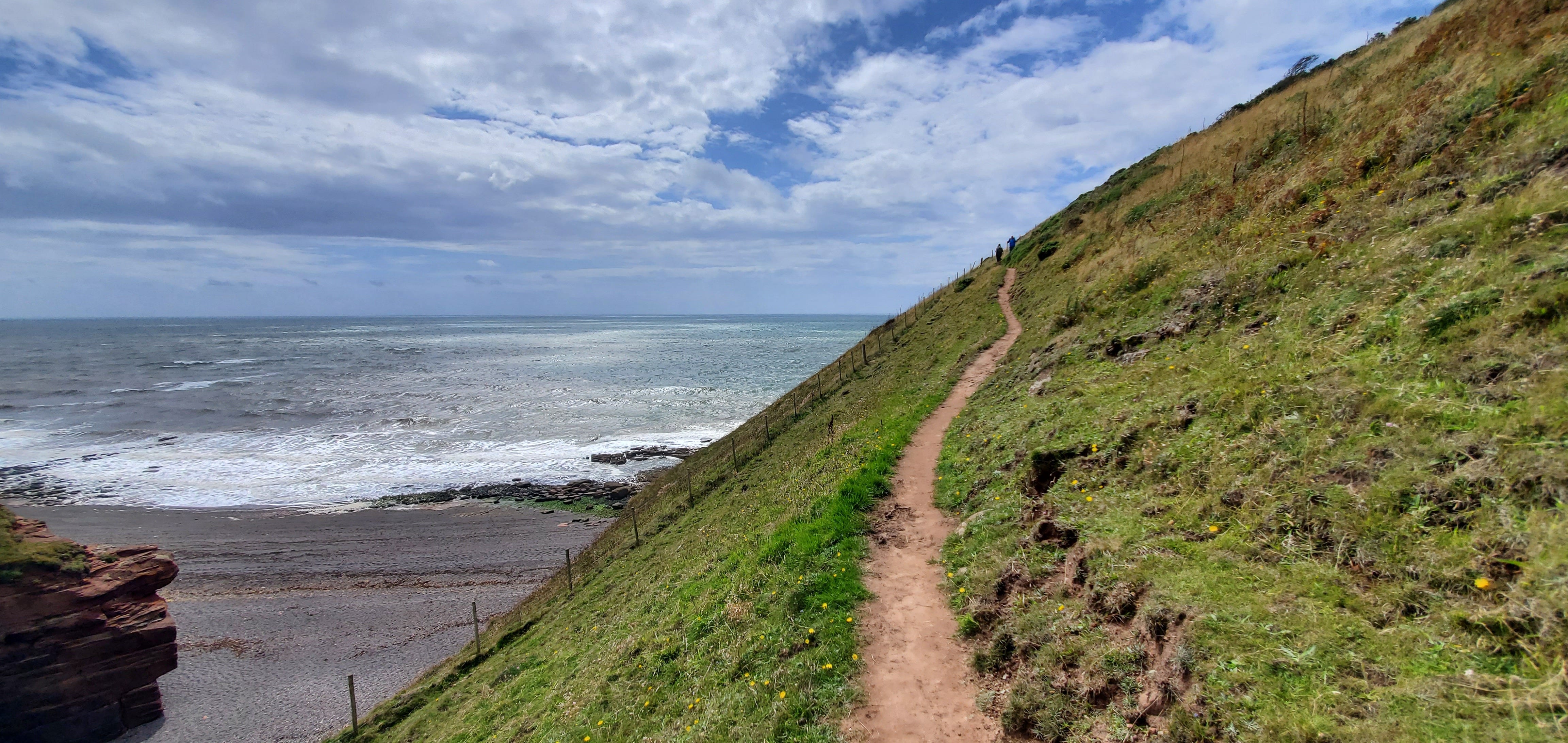
From the beach at St. Bees, the trail begins with a climb to the clifftops, and then follows the cliff edge closely:
Except, wait a minute—what was I thinking?!? On the Coast to Coast Path, each day’s walk normally starts THIS way:
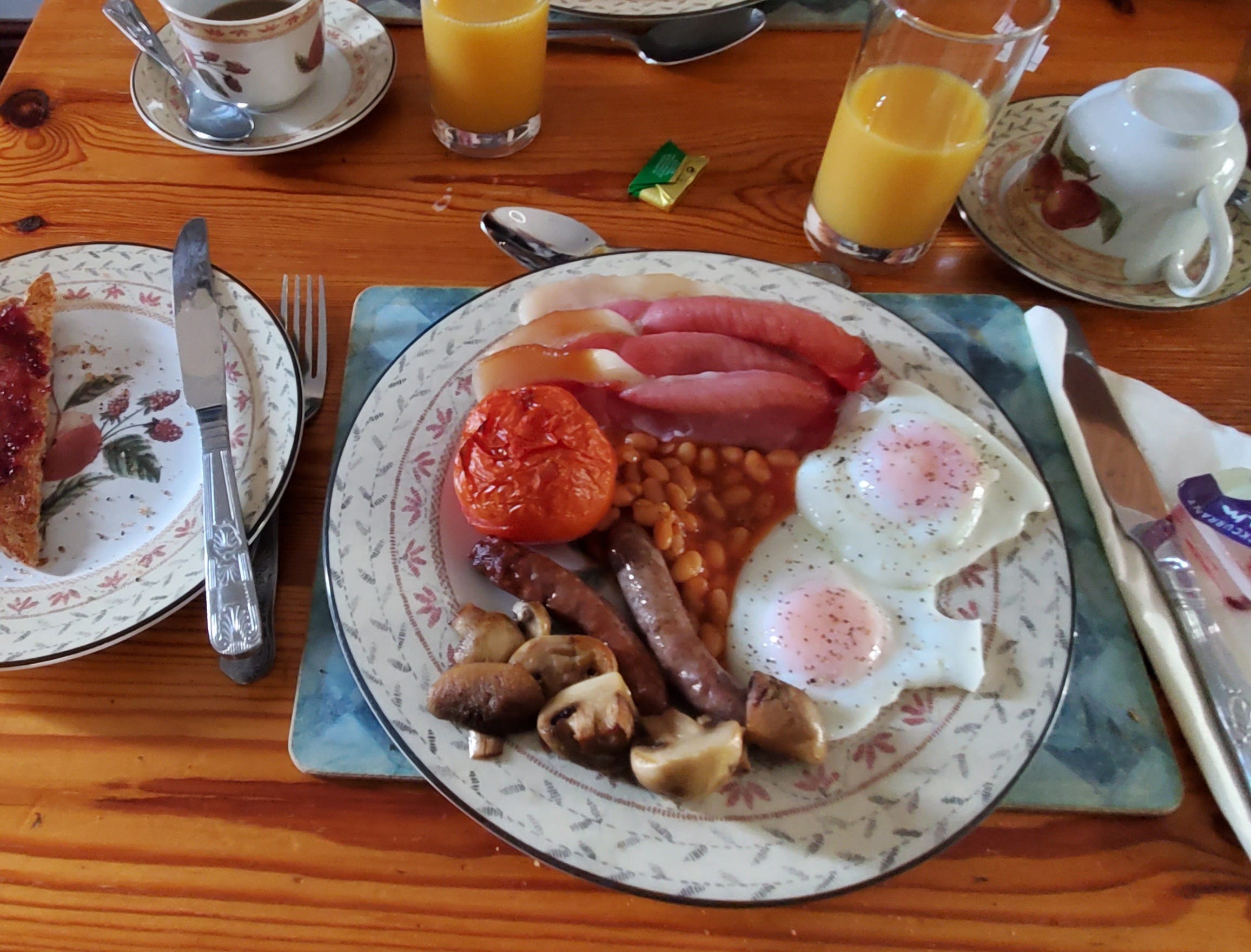
That’s the traditional full English breakfast, or the “full English” as those of us with a dash of pretension like to say: 2 eggs, 2 sausages, 2 slices of what the British call bacon (more like ham to American breakfasters), roast tomato, toast, coffee, juice, and (the horror!) baked beans (to which I say: No. Just, no.) Mushrooms are not uncommon, but seem more optional than the rest.
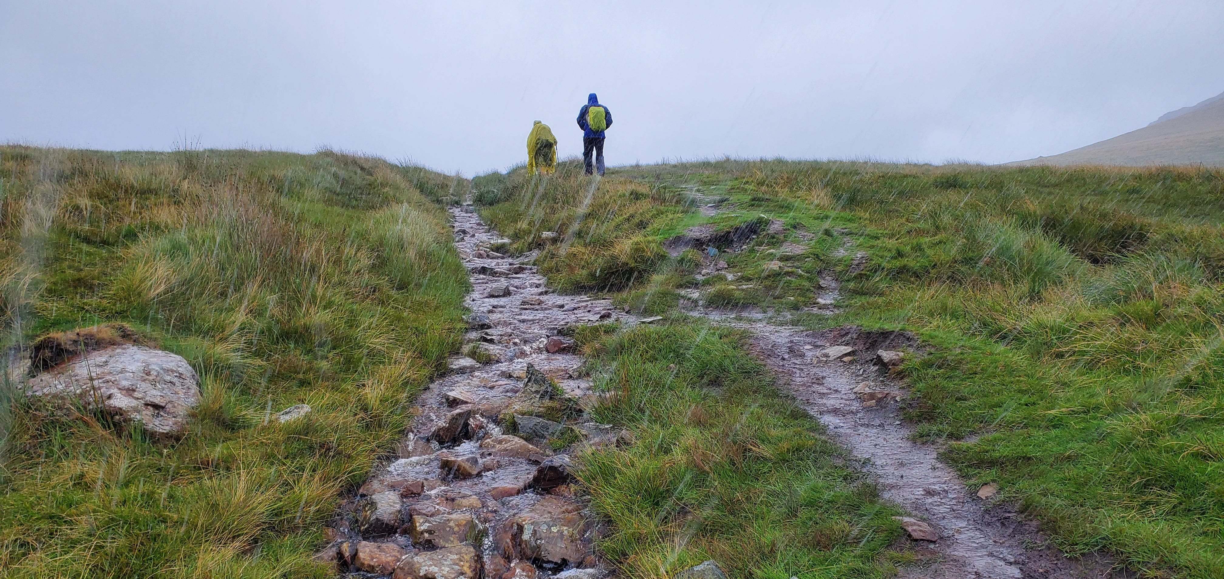
That ought to tell you something about the level of decadence we were forced to endure on this trip, which was the barest pale shadow of the dirtbag wilderness backpacking experiences of my past. We stayed in hostels or B&Bs each night, and even hired a van to carry our luggage, leaving us to carry only a small daypack for water bottles, snacks, and rain gear. And, well, actually, we rarely had to carry rain gear.
Because we were usually wearing it…
But on with the walking. The hike along the sea cliffs from St. Bees on our pre-hike prelude hike was quite nice. Dramatic sea cliffs, sunny weather, and VERY windy, maybe 30 knot gusts? Strong enough to push you around some on the hilltops.
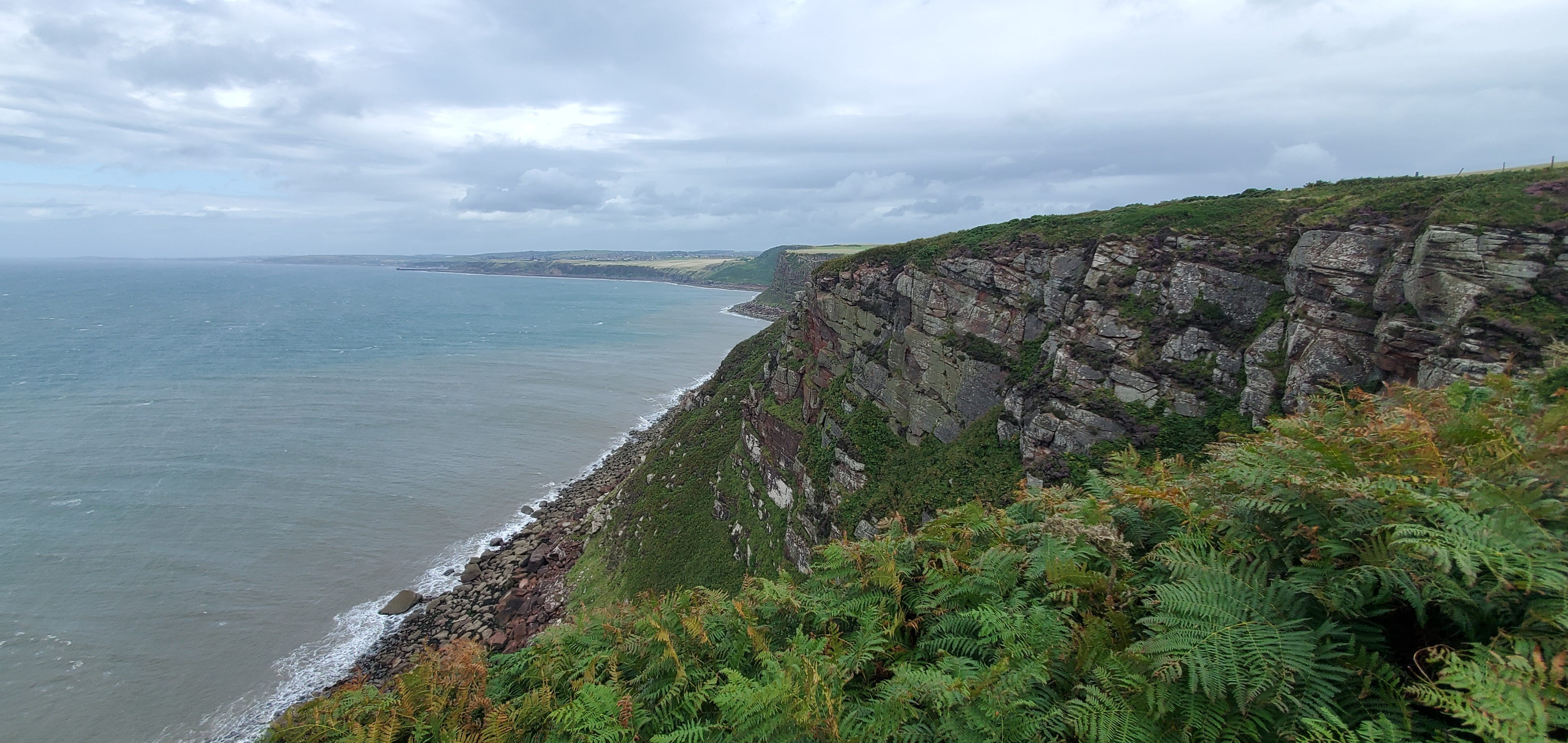
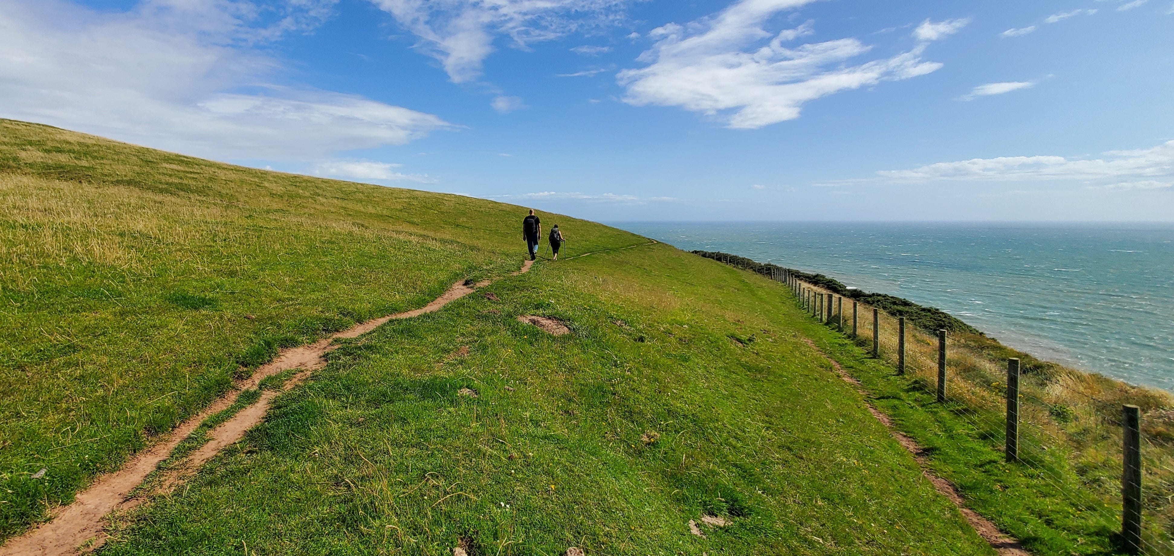
We hiked past the lighthouse and out to the headland, where we could (just barely) see Scotland--or at least, the tall wind turbines lining the Scottish coast north of us. Scotland is just out of the frame to the left in the image below.
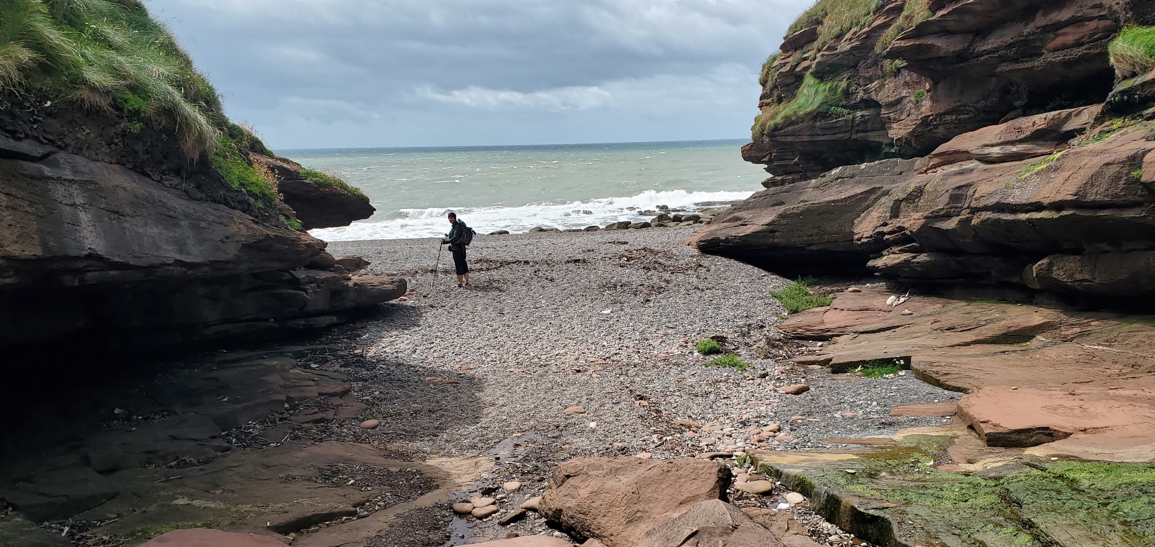
The best part of our hike to St. Bees Head on Day 0 was the beach at Fleswick Bay--a little pocket of beach just off the trail about halfway along, where a trickle of a creek--sorry, in northern England that'd be a "beck"--opened up a narrow access gully down to the Irish Sea.
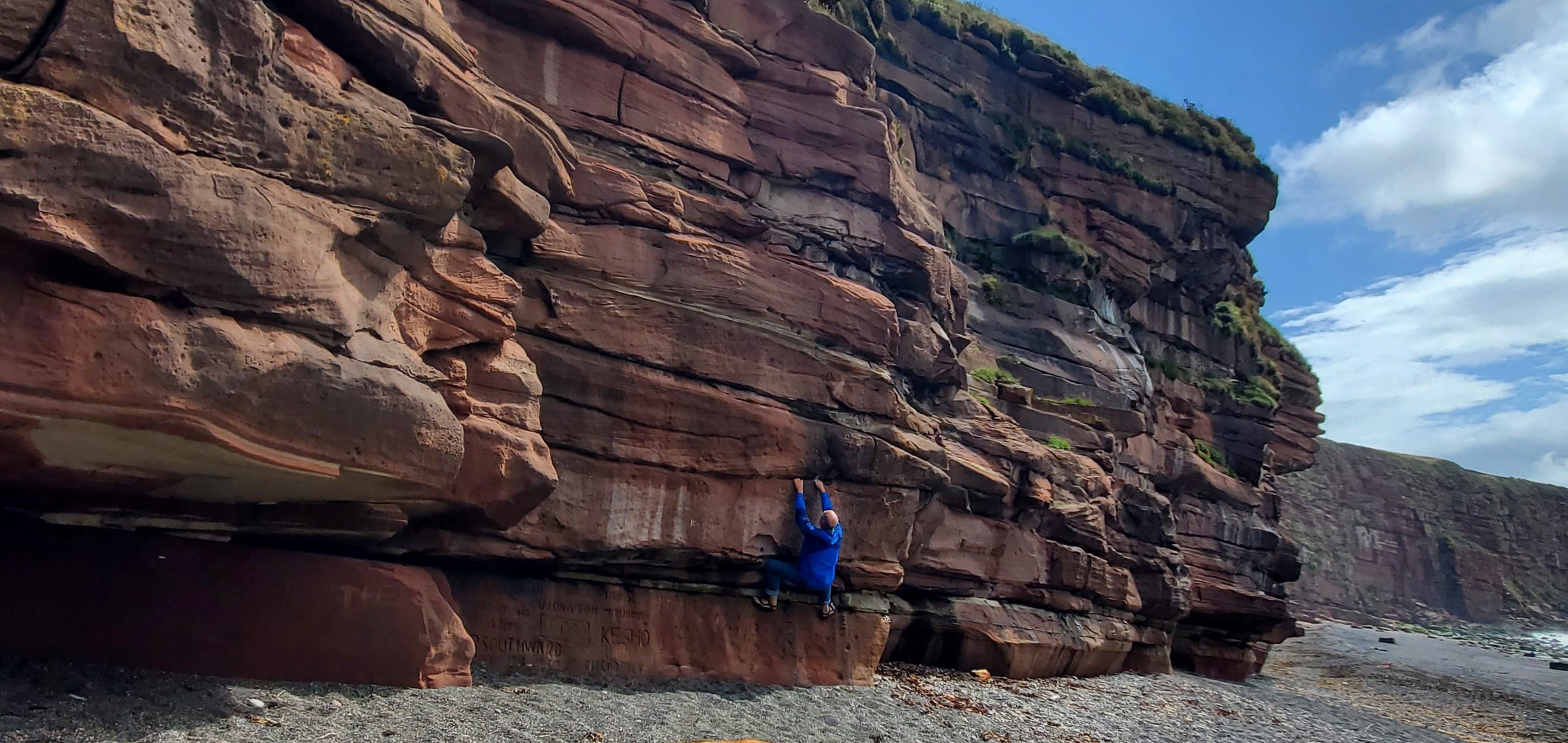
While my wife and sister wandered around the beach taking photos, I found time to do a bit of impromptu half-hearted bouldering:
We spent a good long time here—tall cliffs, crashing waves, all the stuff you expect from the English coast.
And then, of course, we had to climb back up to the clifftops to resume our walk to the lighthouse at St. Bees Head.
There's quite a bit of up-and-downing along these coastal cliff paths--more than you might assume from looking at the coast from a distance in photos. I'd say "hilly" to "very hilly" would describe it.
The popular accounts of this walk say the Wainright route is the equivalent (in elevation gain/loss) of an ascent and descent of Mt. Everest. Well, sure. Without, like, the high altitude death-zone atmosphere, glaciers, crevasses, and all that. Which I don’t think any of us missed much.
Of course, that's lots of flat stretches along the trail, too--something I'm guessing you don't often find on an 8,000 meter peak:
We ended our evening with a walk about town, visiting a Norman church (where, in 1981, the incredibly well-preserved body of a medieval knight was discovered), and stopping by one of the 2 inns for a dinner of fish and chips, with a side of mushy peas.
We had better stop here for now! It’ll take a while to bring you all the way to the North Sea with us on our journey. We hope you enjoy your “walk,” which we’ll aim to finish up in a series of posts over the next week or so. More to come!
What a daunting endeaver. But may the wing be at your backside and the sunshine be on your faces. I love your stories.
I love these and again wish I was 20 years younger! Thanks for taking us along vicariously. I can almost feel the wind and the rain on my back!